.jpg?width=50&name=Spatineo%20-%20JooWorks%20-%20Henkil%C3%B6kuvat0023%20(1).jpg)

In today's interconnected world, geospatial data is no longer just for specialized mapping projects. It's the bedrock of modern urban planning, environmental monitoring, logistics optimization, and countless other critical operations. From satellite imagery to IoT sensor readings and drone captures, the sheer volume of geospatial information being generated daily is staggering.
But this explosion of data, while promising immense potential, often presents a paradox: the more data we have, the harder it can be to find what truly matters. Instead of a clear path to insight, many professionals find themselves navigating a dense fog of information, struggling with fundamental challenges that delay critical decision-making and hinder innovation.
The Discoverability Dilemma: Finding the Needle in the Geospatial Haystack
One of the most persistent bottlenecks is simply discoverability. Businesses and organizations are wasting valuable time and resources sifting through fragmented, unreliable, or irrelevant datasets. Imagine needing a specific type of land-use data for a project in a particular region, only to spend hours, days, or even weeks piecing together disparate sources, verifying their accuracy, and praying they're up-to-date. This isn't just inefficient; it directly delays critical insights and strategic initiatives. The correct data exists, but accessing it quickly and confidently remains a significant challenge.
The Complexity Conundrum: From Raw Data to Actionable Intelligence
Even when the data is found, the journey is far from over. The next hurdle is complexity. Transforming raw geospatial data into actionable visualizations, predictive models, or meaningful reports is a challenging task that often requires extensive data manipulation and highly specialized tools. This isn't a task for the faint of heart, nor is it a quick drag-and-drop operation. The intricate processes involved can be a significant barrier, slowing down analysis and hindering the timely decision-making that complex projects demand. Without efficient ways to process and interpret this data, its actual value remains locked away.
The Talent Gap: The Scarcity of Interdisciplinary Expertise
Compounding these challenges is the pervasive talent gap. Practical geospatial intelligence requires an interdisciplinary blend of skills: software development, data analytics, geoinformatics, and increasingly, AI. Professionals proficient in all these areas are scarce, resulting in intense competition for talent. Companies frequently struggle to find the right experts, resulting in missed opportunities, project delays, and a widening chasm between the data available and the insights that can be extracted from it.
A Legacy of Addressing the Challenge
These aren't new problems; they've evolved with the data landscape itself. At Spatineo, we've been deeply engaged with these challenges from our very beginning, committed to simplifying the use of geographic information for over a decade.
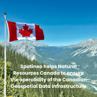
Our journey began in 2011 with Spatineo Directory, which established a global collection of open GIS data—a monumental task aimed at centralizing discoverability. Building on this, Spatineo Monitor, launched in 2013, began adding crucial quality information to that data, providing users with invaluable insights into service usage and performance. This was a direct response to the need for trusted, reliable data sources. Furthermore, our Spatineo Geospatial Web Harvester, introduced in 2016, automated the complex process of cataloging these services into major geospatial data infrastructures, such as the Arctic SDI and the Canadian Geospatial Data Infrastructure (CGDI). This continuous innovation reflects our belief that while the challenges are immense, so is the potential for more innovative solutions.
Towards a More Connected Geospatial Future
The good news is that these challenges are widely recognized, and initiatives are underway to address the systemic issues of data fragmentation and access. The concept of data spaces, for example, is gaining significant traction as a strategic approach to facilitate secure and seamless data sharing and utilization across various sectors. The European Union's vision for common European data spaces, as outlined here: https://digital-strategy.ec.europa.eu/en/policies/data-spaces, is a prime example of this collaborative effort to create environments where data can flow more freely and be leveraged effectively.
What are your experiences with the current geospatial data landscape? Have you encountered similar frustrations with discoverability, complexity, or the talent required to make sense of it all? What solutions or strategies have you found effective, or what do you believe is needed to navigate this exploding volume of geospatial information truly?
Share your thoughts in the comments below. Let's initiate a discussion on how we, as a professional community, can collectively move towards a future where geospatial data is a clear asset, rather than an overwhelming burden.
.png?height=200&name=Can%20Blog%20Featured%20image%20(1).png)